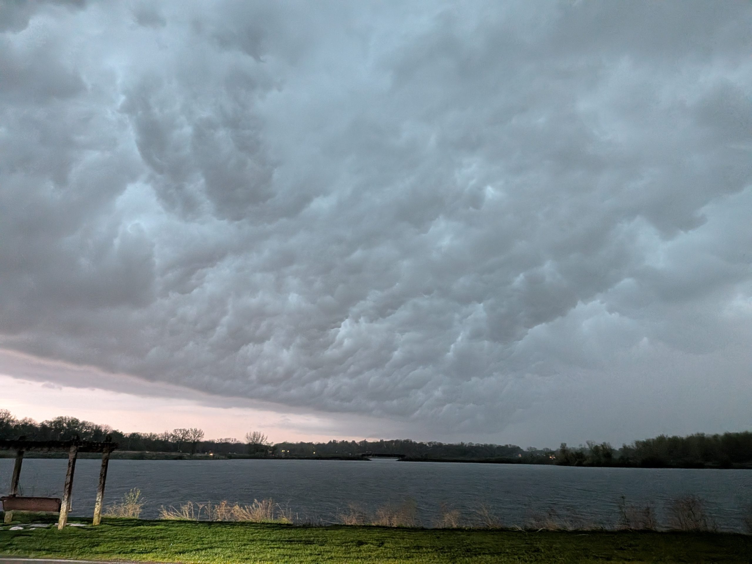
We had an exciting line of thunderstorms pass through Ames this evening. Around 7:15 pm, a tornado warning was issued as a strong squall line passed through and rotation was identified on doppler radar.
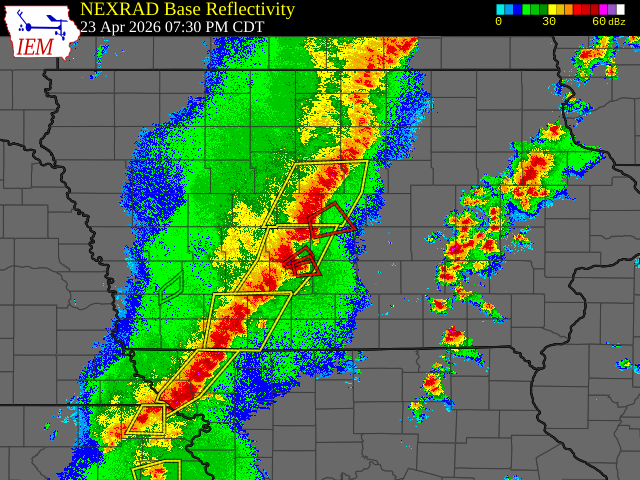
Credit: Iowa State University Atmospheric Sciences dept
Though squall lines do not generally produce strong tornadoes, localized areas of rotation along the squall line, due to different sections moving at different speeds, can result in weak, short-lived tornadoes. The Des Moines National Weather Service saw enough rotation to issue a tornado warning.
As our phone EMS alerts and tornado sirens around Ames all went off – I did what any meteorologist does… I drove out to Ada Hayden Lake to get a better view of the storm. Before leaving, I checked radar to ensure there was no hail and no rain-wrapped areas of strong circulation (which would indicate a dangerous, rain-wrapped tornado).
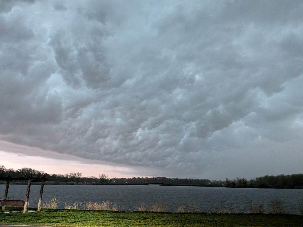
Here’s a picture a picture looking out from Ada Hayden Lake. The beautiful, frightening, turbulent cloud in the foreground is colloquially called the “whale’s mouth,” and it is the underside of the shelf cloud often precedes a squall line. A shelf cloud is a dark, foreboding cloud that is formed as cold air from the storm’s updraft undercuts warm, moist air ahead of the storm and lifts it into the storm updraft. If you find yourself in the whale’s mouth, get ready because heavy rain, strong winds, and light to moderate hail are imminent.
Sophie Miller, one of the students in our atmospheric science cohort, tracked down the area of circulation on radar that caused the National Weather Service to issue the tornado warning. Sophie is an experienced storm chaser and reported that she saw some circulation on the ground, indicating there was a tornado on the ground, though there was not a condensed funnel. In the image below, the blue represents the location of her car (traveling towards Madrid), while the swirl just south of Madrid/west of Highway 17 represents the area of strongest circulation and the likely location of the tornado. The strength of the circulation can be more clearly seen in the red and green radar chart below (I <<believe>> greens indicate precipitation moving towards the radar, while reds indicate precipitation moving away). The adjacent and locally stronger reds/greens are called a “couplet” and indicate circulation/tornado location, with some precipitation in that small space rotating towards the radar while other precipitation rotates away.
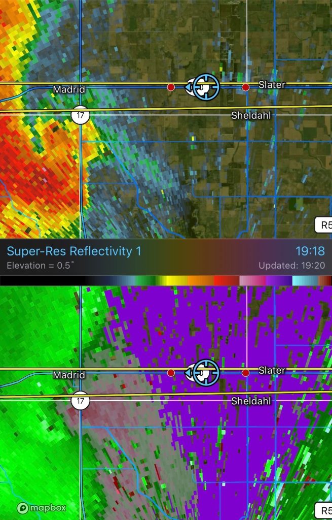
She reported the tornado to the National Weather Service office in Des Moines, and it was listed under the “SPC storm reports” page and has been corroborated with other reports from spotters and the local fire department near Slater, IA. Storm spotters are invaluable for the National Weather Service; many of the weak, short-lived tornadoes like the one that Sophie saw would have gone unnoticed if not for spotters, and when the tornado is not even condensed (meaning there is no visible funnel cloud), many locals would not even be able to recognize it as a tornado; they would likely just attribute it to a random gust of winds within a severe thunderstorm. Good job Sophie!

The weekend and next week looks fairly calm for Iowa, but quite active for the Southern Plains. Some other atmospheric science graduate students and professors are visiting the University of Oklahoma then for graduate research. They’ll have plenty of opportunity to see tornadoes down there, if they can manage a free afternoon between their busy schedules.