1:30 pm:
I am sitting at Morning Bell Coffee Roasters in downtown Ames right now, planning my route for today. One of the first things I learned during my 2017 storm chase is that it’s not just important to plan for the storm location – you have to plan your route and know the road locations! This is especially true today, as these storms are moving to the ENE at 50 mph.

Let’s take a quick look at current conditions. Below image shows visible satellite, surface observations, and lightning flashes. So far, most of the area has seen overcast skies and breezy southerly winds, but a line of thunderstorms has now formed along the Minnesota/Nebraska border with prolific lightning.
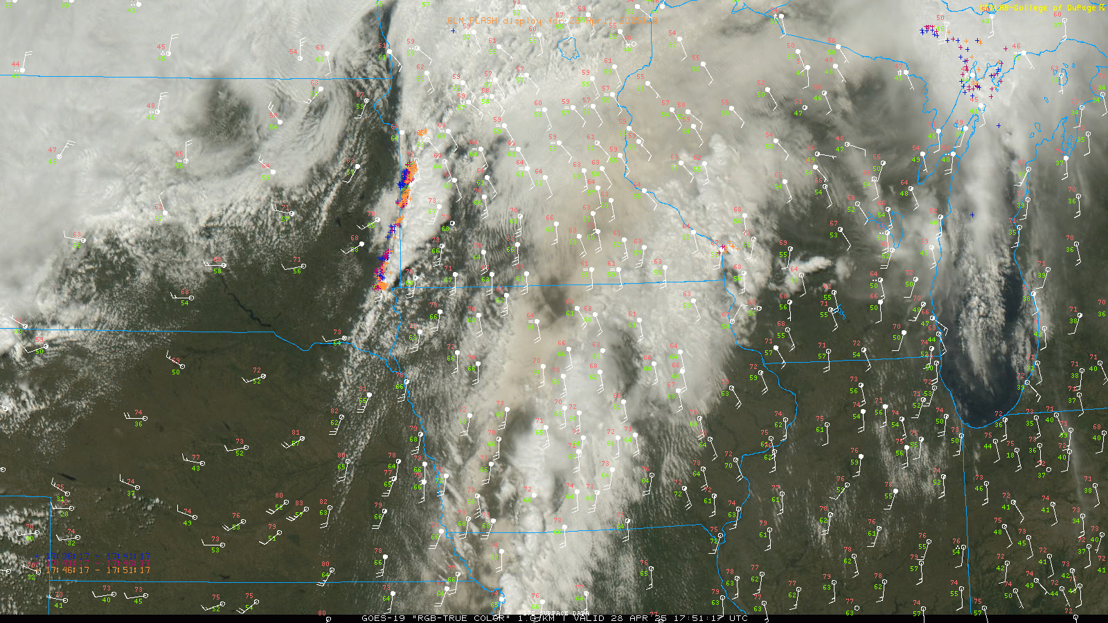
The surface observations show temperature (red), dewpoint (green), wind speed (barb), and cloud cover (circle at head of barb). The thing that stands out is thw diespread mid/upper 60s dewpoints extending into Iowa and Minnesota. VERY impressive for late April. I know the sfc obs are a bit small – click the image to expand.
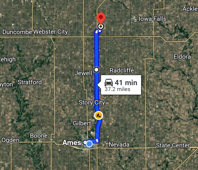
I am leaving momentarily to head towards Williams, approx 40 minutes north of Ames. Williams is at the intersection of I-35 (north-south) and SR 20 (east-west). It’s always nice to be on a major freeway (you can have “chaser traffic jams” in the middle of nowhere!), but it’s especially true when storms are moving as fast as they are today.
As I write this, looks like we now have the first severe thunderstorm warning of the day out in SW Minnesota! Time to go.
Best of luck to you, Charlie!