This week’s atmospheric river lived up to the hype. Nearly every river in Western Washington reached flood stage, and the Skagit, Snohomish, Cedar, and Nooksack Rivers all set new all-time records. The Snoqualmie River came extremely close, and many other rivers reached major flood stage.
What a difference a few months make! Snoqualmie Falls is roaring after back-to-back atmospheric river events in Washington this week. pic.twitter.com/wchPbPVtUX
— AccuWeather (@accuweather) December 10, 2025
I’ve been to Snoqualmie Falls during many atmospheric river events (my mother always took me on “storm chasing” trips as a kid!), and the way you know that the falls are seeing really big flooding is when the water sneaks past the rock at the viewer’s right. The last time I saw it doing that in person was on November 7, 2006; one of the great atmospheric rivers to hit the Pacific Northwest.
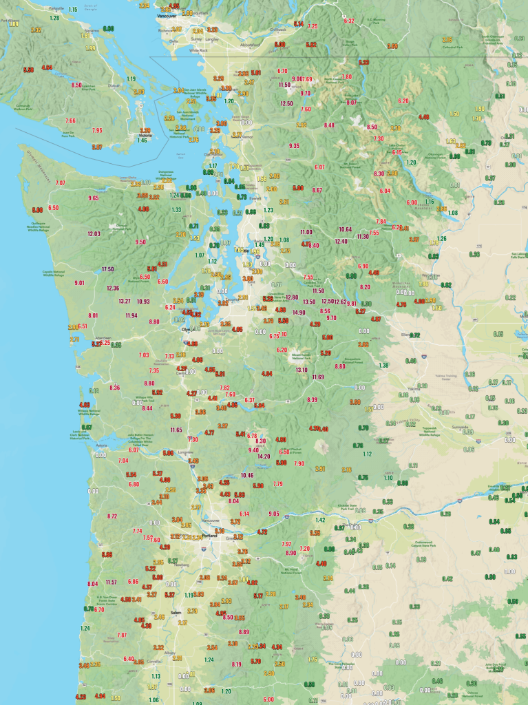
Over the 72-hour period from 12am Monday 12/8 to 12am Thursday 12/11, many portions of the Cascades and Olympics saw over a foot of rain, with Lake Quinalt in the Olympics measuring a staggering 17.50 inches of rain. The June Lake and Swift Creek sites on the south side of Mt. St. Helens saw 14-15″ of rain, Paradise Ranger Station saw 13″, and Skykomish and Stampede Pass both saw 12-13″ .Meanwhile, in the rainshadow downwind of the Olympics, Hansville on the Kitsap Peninsula only saw 0.30 inches and Clinton on the southern tip of Whidbey Island saw 0.21″. The precip increased dramatically as one headed south… the Seattle National Weather Service office at Magnuson Park saw 1.27″, Sea-Tac saw 3.00″, and Olympia, outside of the rainshadow completely, saw 4.88″. Portland Airport saw 3.10″, and precip rapidly decreased south of Corvallis. The below image shows the accumulated rainfall during that 72-hour period at various stations across the Pacific Northwest.
This event is on par with the January 2009 flooding event for the Central Cascades and is potentially a bit worse than that for the North/Central Cascades. It still falls short of the November 2006 event for much of the Washington Cascades (esp. the Mt. Rainier area) and the December 2007 event for the Olympic Peninsula/Willapa Hills/Southwestern WA, but it is the most destructive event we’ve seen in several years.
The Skagit River was particularly hard-hit. Hydrologists and engineers were very worried that the Skagit River at Mt. Vernon would top the levees protecting the city. Thankfully, the levees held and downtown Mt. Vernon avoided catastrophic flash flooding! Evacuation orders were sent to 100,000 citizens in Washington State, including 75,000 people that lived in the Skagit Valley. Nonetheless, many homes and property have been severely damaged by the storm. Thankfully, there are no known fatalities as of this time.
The @komonews drone captured the current Skagit River levels early Friday morning, after cresting yesterday afternoon in Mt. Vernon. Stay up-to-date with @SteveTVNews for the latest news pic.twitter.com/yFR30UuyJs
— KOMO PHOTOG OLEN (@olenhogenson) December 12, 2025
RECORD FLOODING: The Skagit River has now just inched past a new high of 37.43 feet in Mount Vernon.
— Tyler Cunnington KOMO (@TyCunningtonTV) December 12, 2025
Here’s the view looking over the city’s flood wall, as the water has now climbed up halfway, and is slowly leaking through the bottom (that is normal). @komonews pic.twitter.com/EUEyvRO480
Satellite Comparison to Nov 2006, Dec 2007, and Jan 2009
Here is an animation of the 2025 atmospheric river from 4pm, Saturday 12/6 to 4pm Thursday, 12/11. The atmospheric river focused over Washington on Monday, sagged south to Northern Oregon on Tuesday, and rose back north to Washington on Wednesday.
Animation of the #atmosphericriver from 4pm, Sat 12/6 to 4pm Thu, 12/11 that caused widespread #flooding across the PacNW. The AR focused over WA on 12/8, sagged to OR on 12/9, and returned to WA on 12/10. Would have been even worse if it stalled over WA the entire period!! #wawx pic.twitter.com/RhrppFTuok
— Charlie Phillips (@WeatherPhillips) December 12, 2025
I put together a few other animations of the major atmospheric rivers we saw in the late 2000s below. The Nov 2006 event is probably the most similar, but it stalled directly over Western WA for the entire duration and was more severe in most locations. January 2009 was also similar but arrived from a more westerly direction. The December 2007 was a different beast, as the flow was southwesterly and the Willapa Hills/Olympics saw the most efficient orographic enhancement of precipitation. Puget Sound also saw significant urban flooding, as the rainshadow was located closer to Sequim. Finally, the December 2007 event brought widespread 100+ mph gusts to the coast and prompted the Portland NWS to issue its first-ever “Hurricane Force Wind Warning.” Communities along the Northern Oregon and Southwest Washington Coast lost power for a week or more, and the storm was officially named the “Great Coastal Gale” of 2007.
And here's the loop from 4pm 11/2/2006 to 4pm 11/8/2006, famous for bringing 18" to Mt. Rainier Ntl Park in 36 hrs. #Atmosphericriver was similar to 2025, but stalled over WA the entire period. If 2025 had stalled like 2006, flooding would likely be even worse than 2006! #wawx pic.twitter.com/O5YbMho8YK
— Charlie Phillips (@WeatherPhillips) December 12, 2025
Here is the satellite loop from 4am 11/30 – 2am 12/4 of the 2007 #GreatCoastalGale and #atmosphericriver.
— Charlie Phillips (@WeatherPhillips) December 12, 2025
2007 had 100mph winds along coast, winds much weaker in 2025. 2007 also had more SW'erly direction, favoring Olympics/Willapa Hills with record flooding for Chehalis. #wawx pic.twitter.com/GS3Xi3yWSa
Here is the Jan 2009 #atmosphericriver, which brought record flooding to Central Cascades (esp. Snoqualmie). Note the more westerly direction than 2006 or 2025. Very strong rainshadow over Seattle while Cascades saw a foot of rain! Loop from 4pm 1/4 – 4pm 1/9. #wawx pic.twitter.com/HzxyCD7SgW
— Charlie Phillips (@WeatherPhillips) December 12, 2025
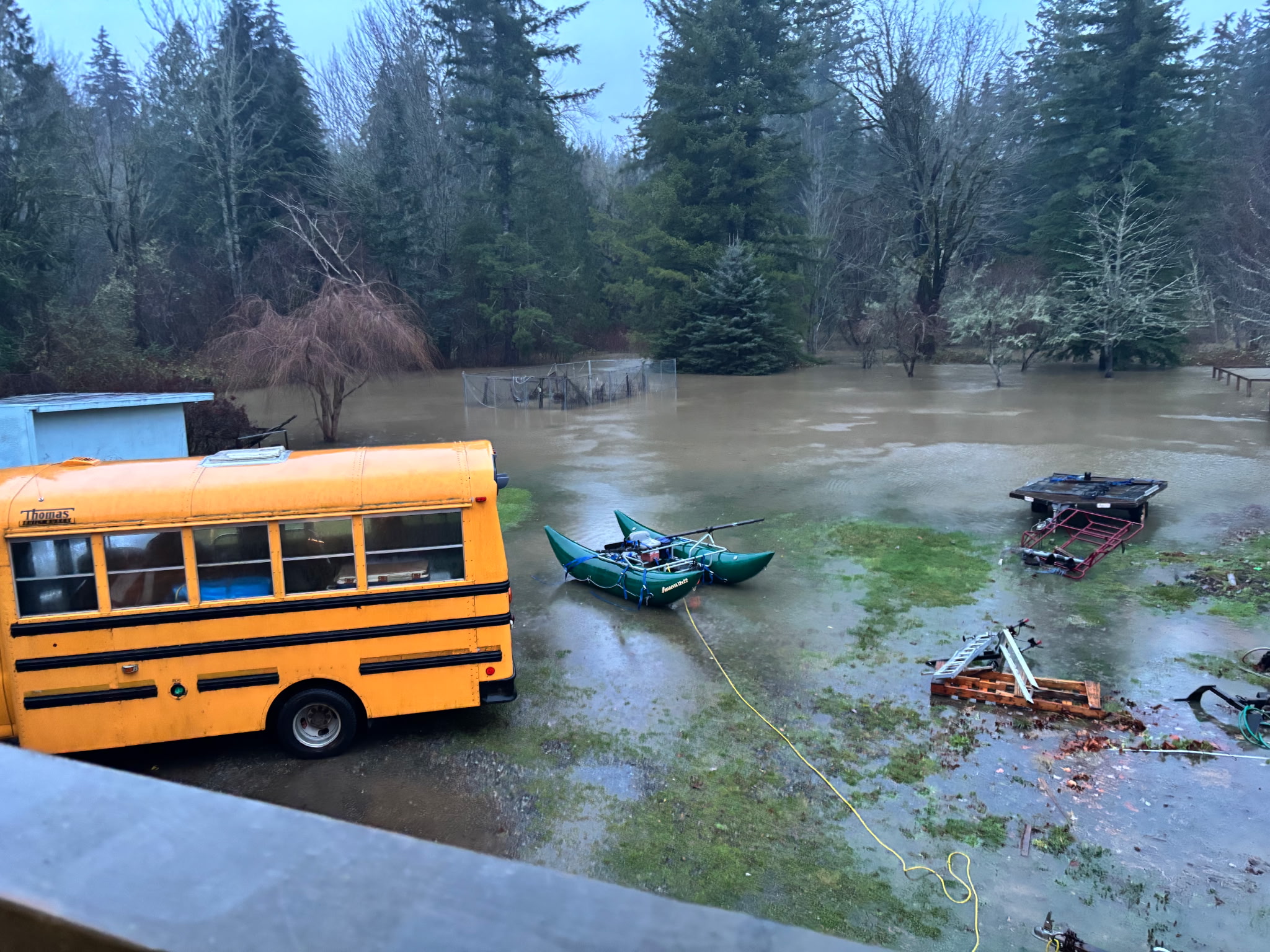
My aunt and uncle live in the town of the Snoqualmie, and their home is built on stilts and used to get regularly flooded. The major floods of Nov 2006 and Jan 2009 brought approximately 3-4 feet of water to their home! Shortly after the 2009 flood, the town of Snoqualmie did some serious flood mitigation work and they had not been flooded since. That is… until this event.
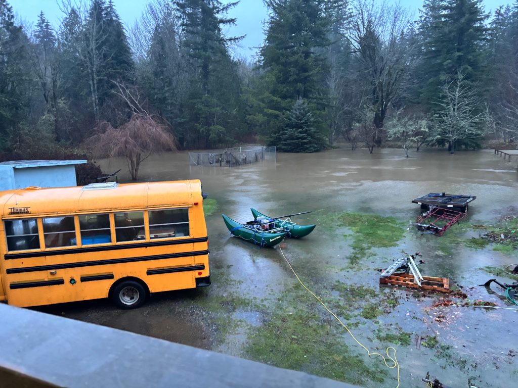
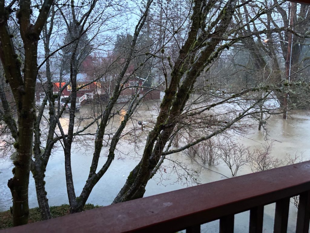
This time, they received a few inches of water in their basement but thankfully did not see any property damage. Above are some picures from their backyard (left) and front yard (right). They are big river rafters… note the green inflatable pontoon!
Heavy Rain Returns Next Week
Yet another atmospheric river will arrive Monday and Tuesday. The UW WRF-GFS is calling for 1-2″ of rain in the lowlands and 3-5″ of rain in the mountains. Significantly less than the most recent event, but still enough to cause some minor flooding on Westside rivers that are running high from this most recent deluge.
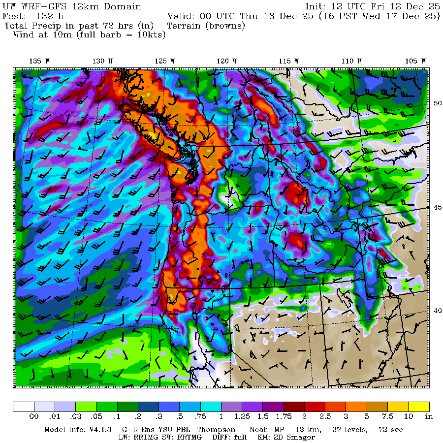
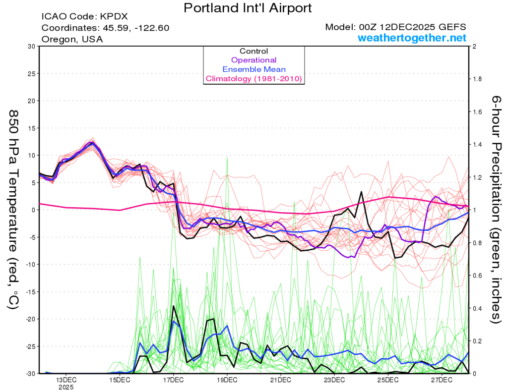
The pattern will shift to cool and showery after this atmospheric river and we may finally get some snow in the mountains. The GFS ensembles show this well, with most members transitioning to a cool/showery period after the 17th and persisting through the rest of 2025. I expect a few ski resorts will open shortly after the New Year.